
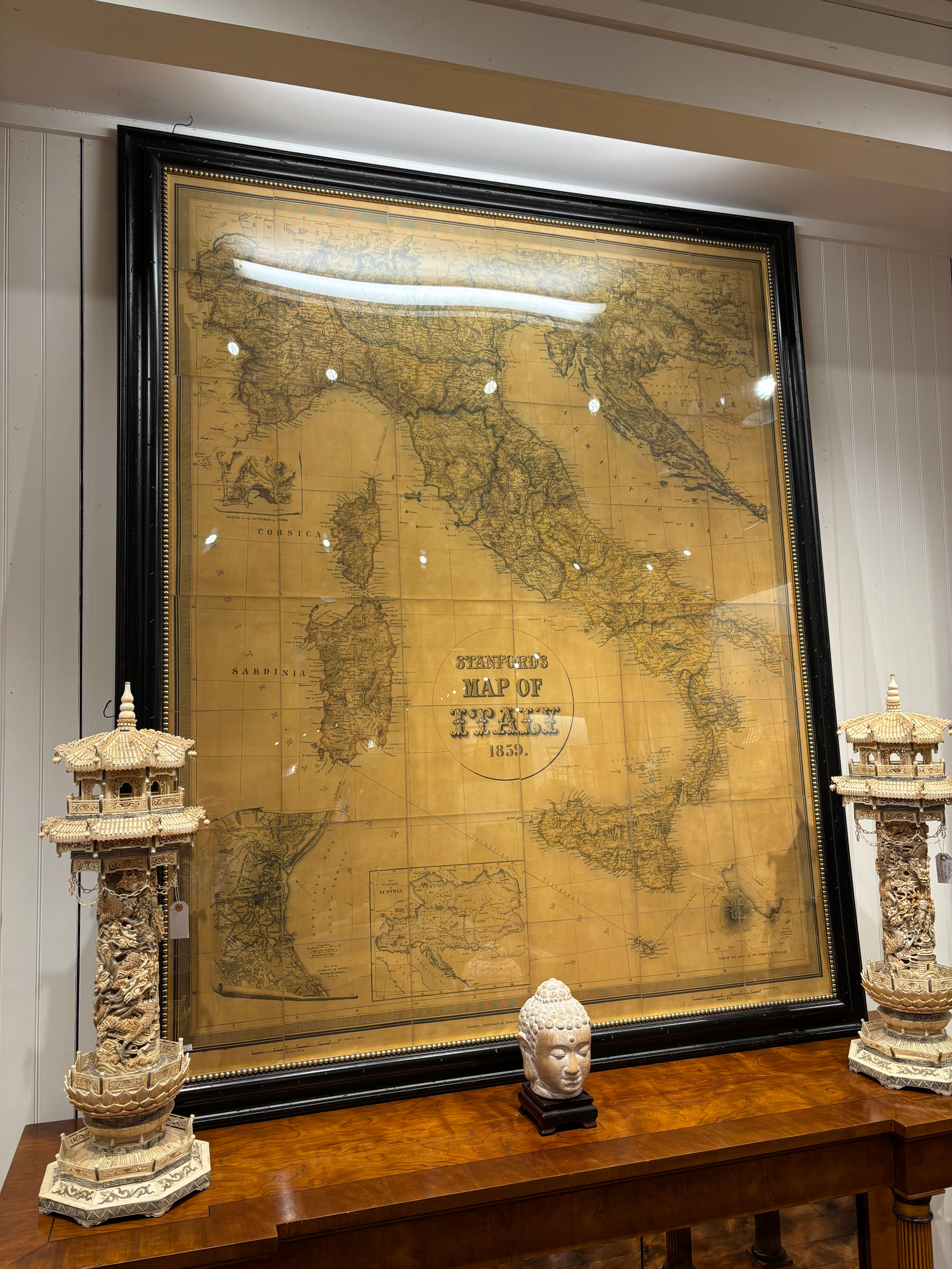

Antique Large-Scale 1859 Stanford’s Map of Italy - Custom Framed
Description: A rare and impressive large-scale historical map titled "Stanford's Map of Italy," dated 1859. This detailed cartographic work covers the entire Italian peninsula, including Corsica, Sardinia, and Sicily, with an inset map of the Austrian Empire. The map is mounted on a grid and showcases intricate topographical and political details. It is professionally housed in a massive, high-quality black lacquered frame with a gold-beaded inner slip, protected by plexiglass.
Good Antique Condition.
• Map: The paper shows a beautiful warm amber patina consistent with age. There is some minor foxing and light creasing along the grid lines, but no major tears or significant losses are visible.
• Frame: The frame is in excellent structural condition with minor surface dust; the glass is intact and clear.
Size: 84” H x 71” W
Weight: Approx. 100 lbs